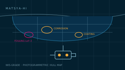
A vision payload and analysis pipeline for ROV and diver-held hull survey. It turns an hour of murky video into a georeferenced hull map with every corrosion patch, coating breakdown, weld anomaly and fouling zone measured, graded and placed.
The problem
What this exists to solve.
In-water survey footage is long, dark and unstructured. A surveyor watches hours of it and writes prose. Nothing is measured, nothing is positioned on the hull, and the next survey cannot be compared to this one — so coating breakdown is discovered in drydock, when the scope is already fixed and the yard slot is already booked.
Our approach
How MATSYA-HI handles it.
MATSYA-HI runs turbidity-robust enhancement and defect segmentation on the ROV feed while simultaneously building a photogrammetric surface model of the hull. Every finding lands on that model with a real position and a real dimension in millimetres, so survey N+1 is a difference against survey N rather than a fresh opinion.
Capability
What it does well.
Coverage you can prove
A coverage map shows exactly which hull panels were surveyed and which were missed, which is the first question any class surveyor asks.
Measured, not described
Findings carry millimetre dimensions and panel positions instead of narrative — repair scope becomes quotable.
Survey-over-survey delta
Corrosion rate and coating degradation are computed against prior surveys, turning inspection into condition trending.
Human confirms every finding
Nothing enters the class report unconfirmed. The AI triages and measures; the surveyor decides.
Drydock scope before the slot
Findings arrive early enough to change the yard scope while it can still be changed.
Specification
Technical data.
Figures are typical values at nominal conditions. Acceptance criteria are agreed per programme and verified at trials — we do not quote a number we will not demonstrate.
| Optical payload | Stereo pair 2 × 4K global-shutter, 12000 lm bar, 5000 K |
|---|---|
| Defect classes | General & pitting corrosion, weld-metal and grooving corrosion, cracks, deformation, coating breakdown, blistering, biofouling |
| Fouling grading | Level of Fouling scale LoF 0–5, per-panel, IMO biofouling-guideline aligned |
| Measurement accuracy | ±2.5 mm at 1 m stand-off in 1.5 m visibility |
| Turbidity handling | Backscatter suppression + optional multibeam overlay to 0.3 m visibility |
| Hull map output | Textured 3D model, panel-indexed, aligned to the yard's block plan |
| Positioning | USBL, DVL and visual odometry fusion; drift <0.4 m over a 40 m run |
| Reporting | Class-ready PDF with coverage map, confidence bands, per-finding evidence frames |
| Comparison | Automatic delta against any prior survey of the same hull |
| Compatibility | Mounts on common inspection-class ROVs; also available as a diver-held rig |
Start a conversation
Evaluate MATSYA-HI on your platform.
We run structured evaluations: a defined operating profile, an agreed acceptance criterion, and a trials report you can take to your own review board.